





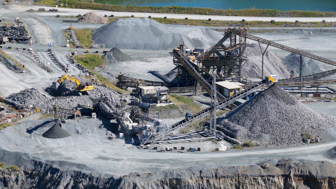
Rare earths for magnets, lithium and cobalt for batteries, platinum group metals for catalysts — the supply chain that feeds green energy and advanced electronics rests on minerals we still struggle to find efficiently. Hyperspectral satellite imaging changes the math, says Kateryna Sergieieva, scientist at EOS Data Analytics.
Mining companies have spent the better part of a century looking for critical raw materials the hard way: boots on the ground, drill rigs are placed on intuition, and budgets are spent ineffectively. That approach doesn’t work for the specialty chemical manufacturers’ demands now.
But now manufacturers can explore live satellite images from hardware with sensors like EnMAP and PRISMA, which can read the chemical fingerprints of rock itself.
What makes hyperspectral different?
Traditional satellite sensors like Sentinel2 or Landsat capture images in a handful of broad spectral bands — red, green, blue, nearinfrared, and a few others. It’s enough to tell a forest from a field, but not enough to tell one mineral from another.
Hyperspectral sensors work differently. They record reflected light in hundreds of narrow, continuous bands stretching from visible light into the shortwave infrared. Every pixel on the ground comes back with a full spectral curve rather than a few crude readings. This is a different exercise from pulling up current satellite imagery of a region to check what’s on the surface. A standard live satellite view of Earth shows you terrain, roads, and cloud cover in something close to real time. Hyperspectral data shows you what the rock is made of.
Minerals and the alteration products that surround ore deposits — clays, carbonates, iron oxides, sulfates — each absorb light at specific wavelengths. So from orbit, geologists can estimate mineral composition and map the alteration zones that point toward buried deposits — before anyone signs a lease or moves a drill rig.
From pixels to potential deposits
For specialty chemical makers, where a deposit sits and how pure it is can decide whether it’s worth anything. This is where EnMAP and PRISMA prove their value. Both are hyperspectral satellites — EnMAP, a German mission, and PRISMA, an Italian one — and both pick out hydrothermal alteration zones, the chemical halos that hot, ore-bearing fluids leave behind as they push through rock.
From orbit, they read the surface in fine spectral detail and flag patterns geologists have learned to trust. Find kaolinite, alunite, and pyrophyllite together, and you’re often near a porphyry copper system. Magnesium-rich chlorite and serpentine tend to flag nickel laterites instead. This helps to narrow drill targets before anyone has to hack through jungle or cross open desert.
The physics behind it isn’t new. Every mineral handles light a little differently, and the differences come down to two things:
- Electronic transitions, in the visible and near-infrared range, where electrons jump between energy levels inside atoms.
- Vibrational responses, further out in the near- to shortwave infrared, where molecular bonds stretch and bend.
The field record bears this out. Swayze and his colleagues mapped the alteration at Cuprite, Nevada, back in 2014 — still one of the most-studied test sites in the business. A decade later, in 2024, Asadzadeh’s team used the same approach to map REE-rich carbonatite at Mountain Pass, California.
Real-world impact on specialty chemicals
The case studies point in one direction: cheaper, faster, lower-risk discovery.
- Lithium clays, Nevada. Researchers have used spaceborne hyperspectral data to map lithium-bearing hectorite in claystone deposits — the same geology behind Thacker Pass, the largest known lithium resource in the US, which Lithium Americas began constructing in 2023.
- Carbonatite REEs, Finland. Work in the Fennoscandian Shield, home to the Sokli carbonatite complex, has used hyperspectral and remote sensing methods to flag REE-enriched zones, sharply cutting the ground that needs costly airborne follow-up.
Tailings as a resource. This is the underrated part. Old mines often left valuable material in their waste. Mountain Pass in California — the only operating REE mine in the US, restarted by MP Materials — sits on decades of processing history, and hyperspectral mapping can detect residual concentrations in tailings that were once written off as liabilities.
Challenges and the road ahead
None of this works like magic, and some companies can face some disappointment due to existing limitations:
- Resolution. EnMAP and PRISMA deliver roughly 30 meters per pixel. That’s fine for mapping broad alteration zones, but it misses narrow veins and small outcrops — exactly the targets that sometimes carry the richest grades.
- Clouds. Optical sensors can’t see through them. Anyone who has tried to find current satellite images of Earth for a tropical region knows the frustration — persistent cover can blank out a target area for weeks. Hyperspectral exploration faces the same wall.
- Data weight. A single hyperspectral scene is a dense cube of hundreds of bands. Pulling a mineral map out of it takes machine learning and a geologist who knows what the spectra actually mean.
But the direction of this development is clear. Commercial constellations are flying hyperspectral sensors with regular revisits, and NASA’s planned Surface Biology and Geology (SBG) mission will add open-access data and sharper spectral quality.
Access is also getting easier. Where geologists once waited on commissioned flights, much of this data now sits in open archives. EnMAP and PRISMA scenes can be browsed and ordered through their agencies’ portals, the way you’d pull a satellite view live through a public catalog. Knowing how to find current satellite images — and which mission flew the cleanest pass over your ground — is becoming a core exploration skill.
Frequent revisits mean the most current satellite imagery of a prospect is rarely more than a week or two old, and a quick current satellite view of a license area can confirm access routes and terrain before a single geologist is deployed.
Conclusion
The real question for the specialty chemicals industry isn’t whether hyperspectral imaging can find critical raw materials. It already does. The question is which companies move first and which wait until their competitors have mapped the best ground.
Turning satellite pixels into mineral maps means new sources of lithium, rare earths, and the other elements that advanced chemistry runs on — found with less drilling, less wasted capital, and a lighter footprint on the land.
- Kateryna Sergieieva has a Ph.D. in information technologies and 15 years of experience in remote sensing. She is a scientist responsible for developing technologies for satellite monitoring and surface feature change detection. She is an author of over 60 scientific publications.